Territorial Planning & Intelligence
In developmentSGT Territorio
Integrates artificial intelligence, IoT, advanced analytics and digital twins to understand the behavior of the territory and support strategic decision-making.
SGT Territorio is the territorial-intelligence platform of the SGT Ecosystem. Its purpose is to transform large volumes of environmental, social, economic and territorial information into knowledge useful for public management. The system integrates information from IoT sensors, monitoring stations, predictive models, artificial intelligence, satellite imagery, drones and data observatories to build a dynamic view of the territory. Its main goal is to develop Territorial Digital Twins, capable of representing the behavior of the territory in real time, anticipating future scenarios and supporting the design of public policy, territorial planning and risk management.
Request a demo for SGT Territorio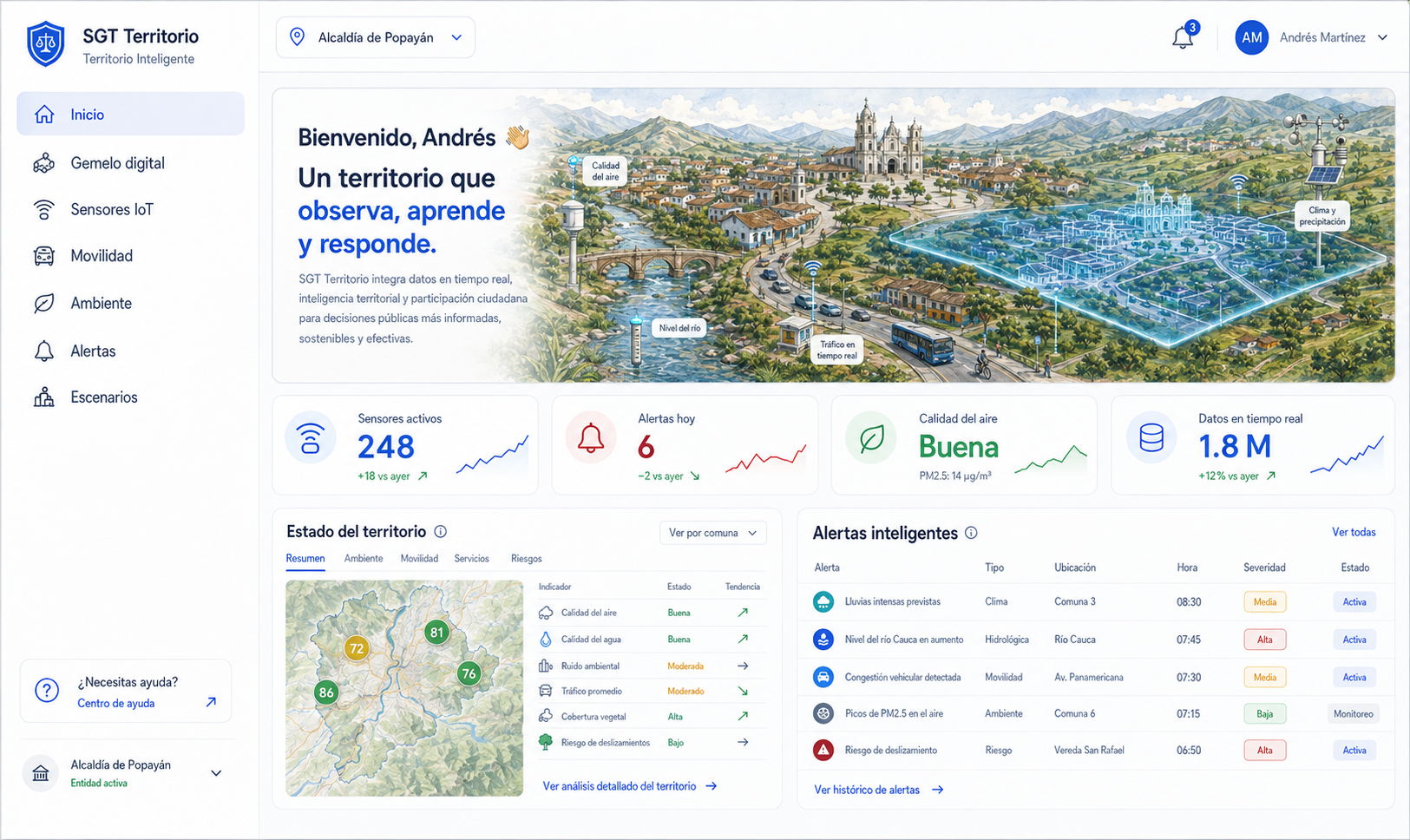
What it does
Key features
Building of Digital Twins of the territory.
Integration of information from IoT sensors.
Real-time environmental monitoring.
Smart agriculture.
Smart natural-resource management.
Disaster risk management.
The challenge it solves
Territorial entities have large amounts of information from different sources, but that information is usually scattered and does not make it possible to understand the behavior of the territory or anticipate future risks or needs.
Concrete results
Benefits
Supports evidence-based decision-making.
Enables building Digital Twins of the territory.
Improves risk management.
Strengthens territorial planning.
Optimizes environmental monitoring.
Enables smart agriculture.
Integrates IoT sensors and real-time information sources.
Enables anticipating scenarios through Artificial Intelligence.
Reduces territorial-analysis times.
Strengthens territorial sustainability and resilience.
Who it serves
Departments and entity type
User departments
Entity type
Why SGT Territorio
The differentiator
Unlike traditional geographic-information platforms, SGT Territorio does not merely display maps; it turns the territory into an intelligent system able to integrate environmental, climate, social, economic and technological information to understand its behavior and anticipate future scenarios through Digital Twins, IoT sensors and Artificial Intelligence.
Requirements & integration
How it integrates
Requires SGT Core, which provides user administration, authentication, security, permissions and the shared services of the ecosystem. It draws information from SGT Geo, SGT Observatory and SGT Intelligence to consolidate a comprehensive view of the territory.
Included services
Implementation support
- Territorial diagnostics.
- Design of Digital Twins.
- Integration of IoT sensors.
- Configuration of monitoring platforms.
- Integration with weather stations.
- Configuration of predictive models.
- Implementation of territorial observatories.
- Integration with satellite imagery and drones.
- Specialized technical training.
- Technical support and technological evolution.

Want to see SGT Territorio in action?
Schedule a personalized demo and we'll show you exactly how it adapts to your entity.