
Territorial Planning & Intelligence
In developmentSGT Geo
Centralizes and manages all of the entity’s geographic and cartographic information, enabling the visualization, analysis and management of the territory from a single geospatial platform.
SGT Geo is the geospatial platform of the SGT Ecosystem. Its purpose is to manage all of the cartographic information of public entities: parcels, infrastructure, roads, utility networks, facilities and POT/EOT layers on an interactive base map. It enables the visualization, analysis and management of any data with a spatial component, integrating cadastral information, aerial photographs, satellite imagery and institutional geographic services on a single platform.
Request a demo for SGT Geo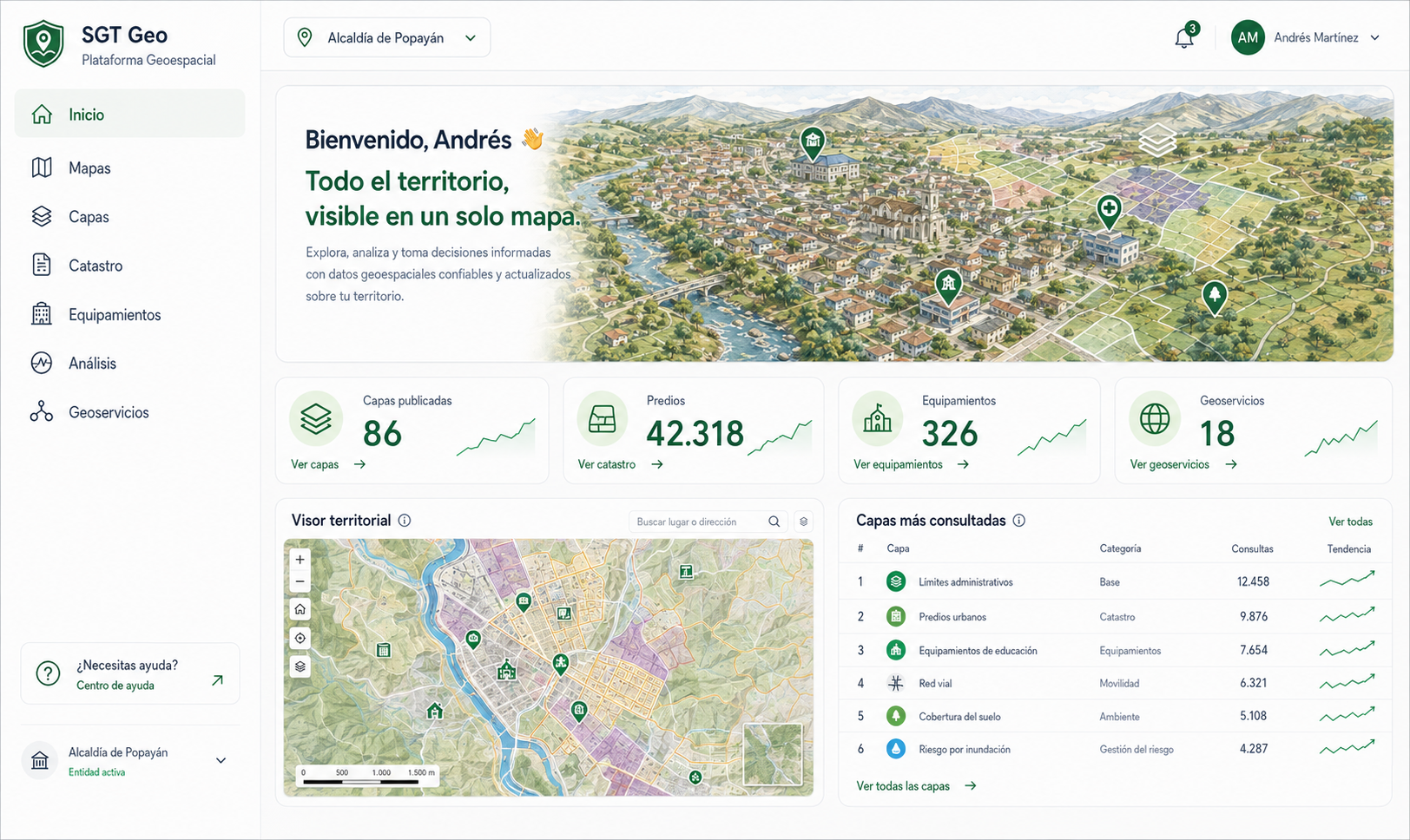
What it does
Key features
Administration of digital cartography.
Management of geographic layers.
Visualization of interactive maps.
Parcel administration.
Management of public infrastructure.
Administration of facilities.
The challenge it solves
Entities’ geographic information is usually scattered across different departments, formats and platforms, making it hard to consult, update and leverage for decisions about the territory.
Concrete results
Benefits
Centralizes all institutional cartography.
Eases access to up-to-date geographic information.
Improves territorial planning.
Optimizes infrastructure management.
Enables georeferencing of assets and projects.
Reduces duplication of cartographic information.
Eases spatial analysis.
Improves coordination across departments.
Strengthens utility management.
Provides a geographic base for other institutional systems.
Who it serves
Departments and entity type
User departments
Entity type
Why SGT Geo
The differentiator
Unlike traditional cartographic platforms, SGT Geo brings all of the entity’s spatial information into a single geospatial infrastructure connected to the SGT Ecosystem, so data from other systems — parcels from Fiscal, contracts from Contracts, assets from Inventory — can be visualized and analyzed on the map of the territory.
Requirements & integration
How it integrates
Requires SGT Core, which provides user administration, authentication, security, permissions and the shared services of the ecosystem. It integrates with SGT Territorio and SGT Observatory to visualize territorial indicators on the map.
Included services
Implementation support
- Gathering of geographic information.
- Migration of existing cartography.
- Configuration of thematic layers.
- Configuration of institutional maps.
- Integration with existing GIS platforms.
- Georeferencing of assets and infrastructure.
- Publishing of geographic services.
- Training in GIS tools.
- Integration with cadastre and utilities.
- Specialized technical support.
Want to see SGT Geo in action?
Schedule a personalized demo and we'll show you exactly how it adapts to your entity.